


Description
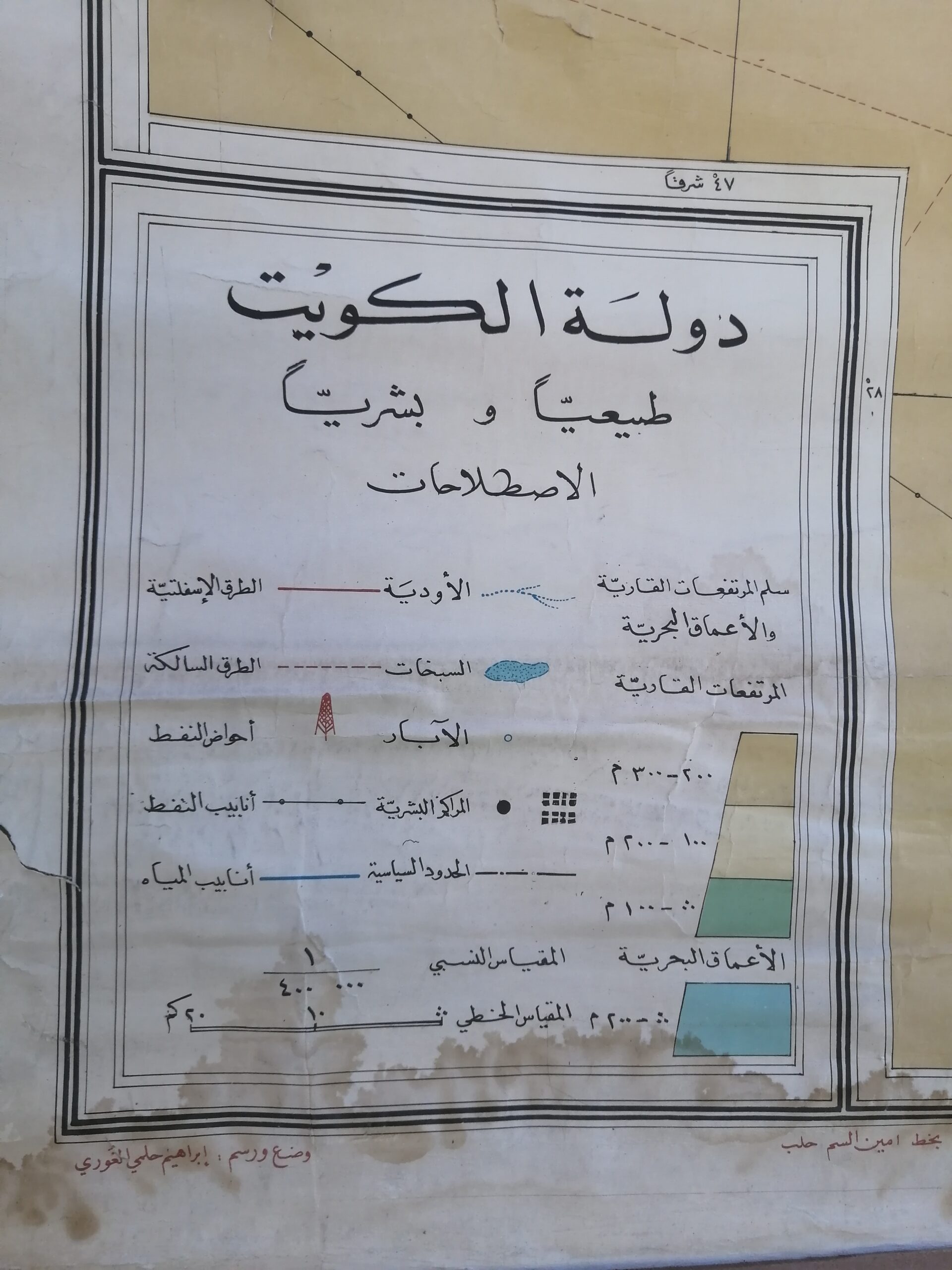
A beautifully preserved mid-20th century educational wall map depicting Kuwait, printed entirely in Arabic. This historical chart highlights geographic, political, and agricultural features of the region, with particular attention to rivers, terrain zones, and urban centers.
Labeled “دولة الكويت” (Kuwait Country), the map presents a post-monarchy Iraq and a newly independent Kuwait, placing it roughly between the 1960s and early 1970s. The soft gradient coloring divides desert, fertile, and aquatic regions, reflecting the cartographic styles of the era. It’s mounted on canvas with original wooden rods and shows light signs of wear, including edge fraying and patina that add to its authentic vintage appeal.
A culturally rich and historically significant piece, ideal for collectors of Middle Eastern history, vintage maps, or educational memorabilia.
Condition: Good with some age-related wear
Language: Arabic
Origin: Lebanon


Reviews
There are no reviews yet.