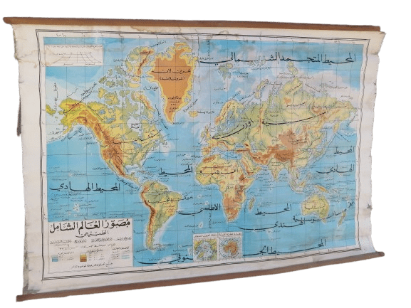


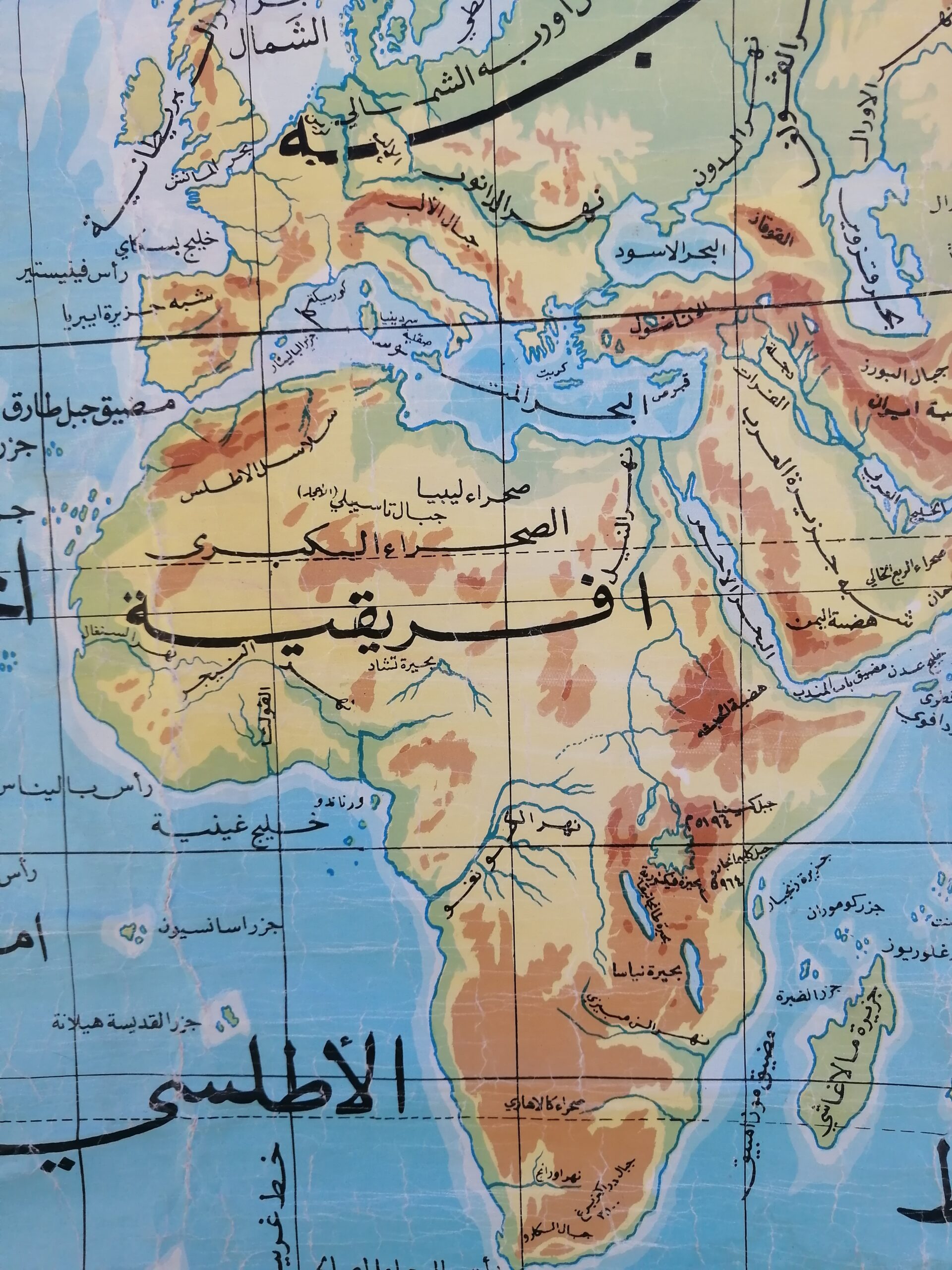


Description
A beautifully preserved vintage Arabic-language world map, showcasing the physical geography of the Earth in vibrant detail. This educational wall chart was designed to highlight the Earth’s mountain ranges, plains, oceans, and elevation zones using color-coded topography.
Title on map: خريطة العالم الطبيعي (Physical Map of the World)
Language: Arabic
Estimated print date: Mid-20th century (c. 1950s–1970s)
Material: Paper backed with linen, mounted on wooden rods
Condition: Good vintage condition with edge wear and slight creasing; natural signs of age
Featuring:
Colored reliefs showing elevation and terrain
Major oceans, mountain ranges, and deserts labeled in Arabic
Insets showing hemispheres and elevation profile
Originally intended for educational use in Arabic-speaking schools
A rare and educational decorative piece, perfect for vintage collectors, geography enthusiasts, or as a striking wall display in libraries, offices, or classrooms.


Reviews
There are no reviews yet.