


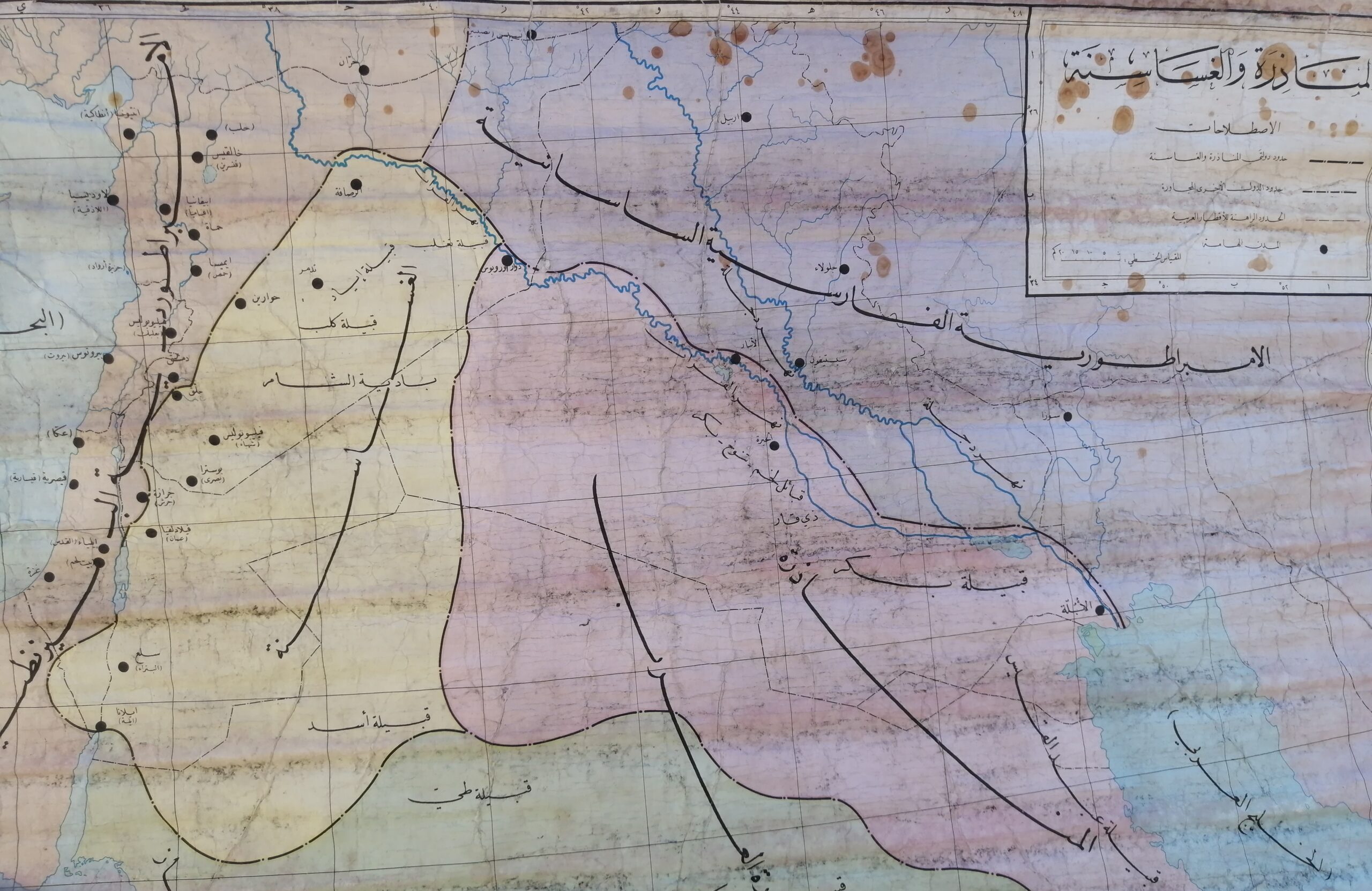

Description
An exceptional antique Arabic-language educational wall map depicting the early Islamic conquests and the expansion of the Islamic Caliphate. The map outlines the routes of military campaigns and the geographical spread of Islamic rule during the 7th and 8th centuries CE, covering regions including modern-day Iraq, Syria, Egypt, the Arabian Peninsula, and parts of Persia.
Language: Arabic
Map focus: الفتوحات الإسلامية (Islamic Conquests)
Estimated print date: Early to mid-20th century
Material: Paper mounted on fabric with original wooden rollers
Condition: Moderate wear with visible water stains and age marks, adding to its vintage appeal
Notable details: Arrows and shaded areas indicate different phases of expansion, major cities and routes of historical significance are labeled
A meaningful piece for collectors of Islamic history, educators, or decorative use in libraries, study rooms, or cultural exhibitions.


Reviews
There are no reviews yet.