

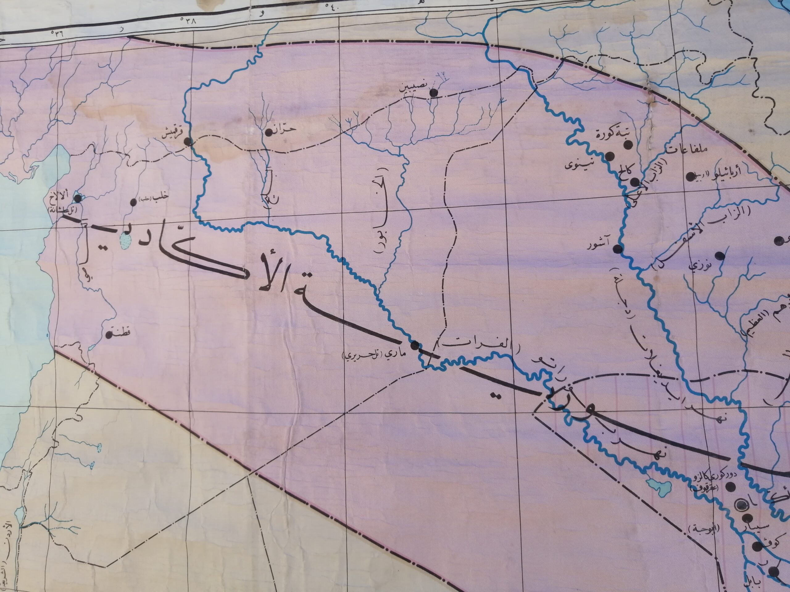
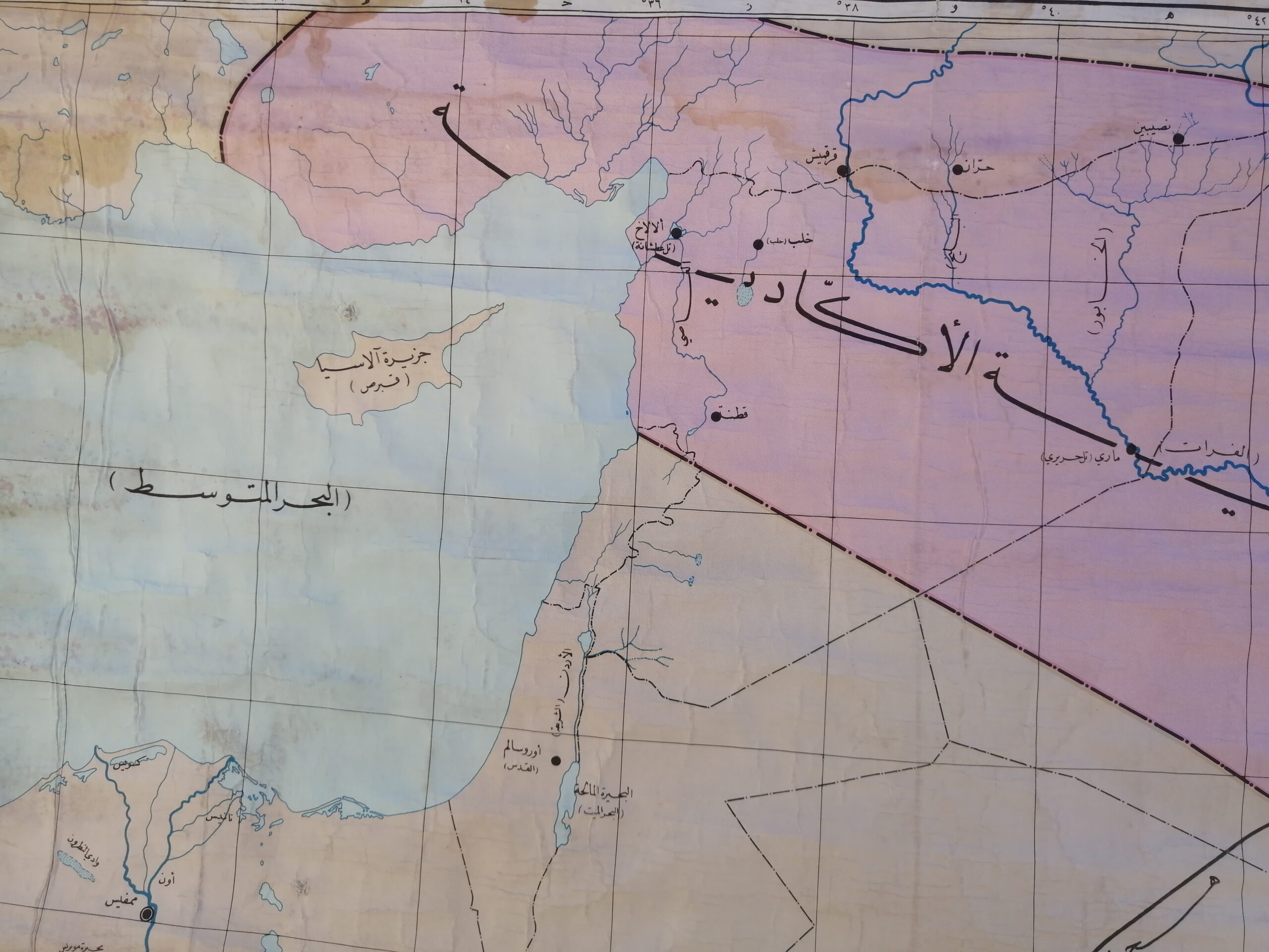
Description
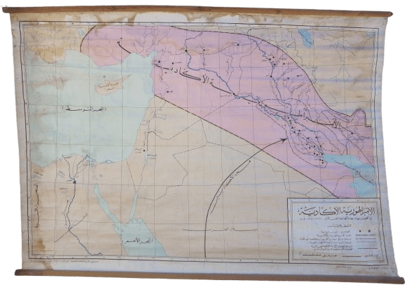
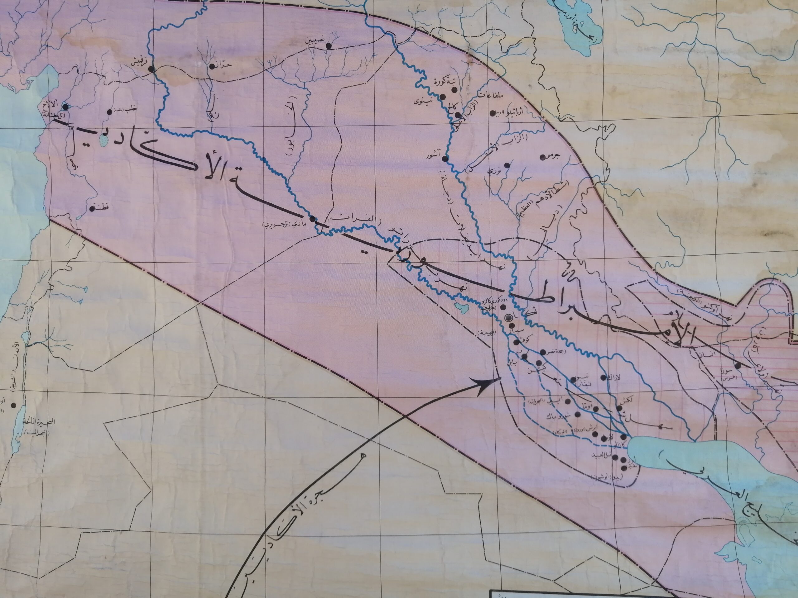
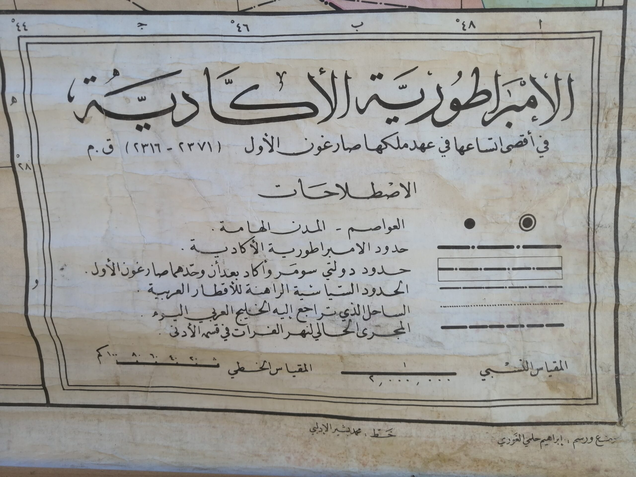
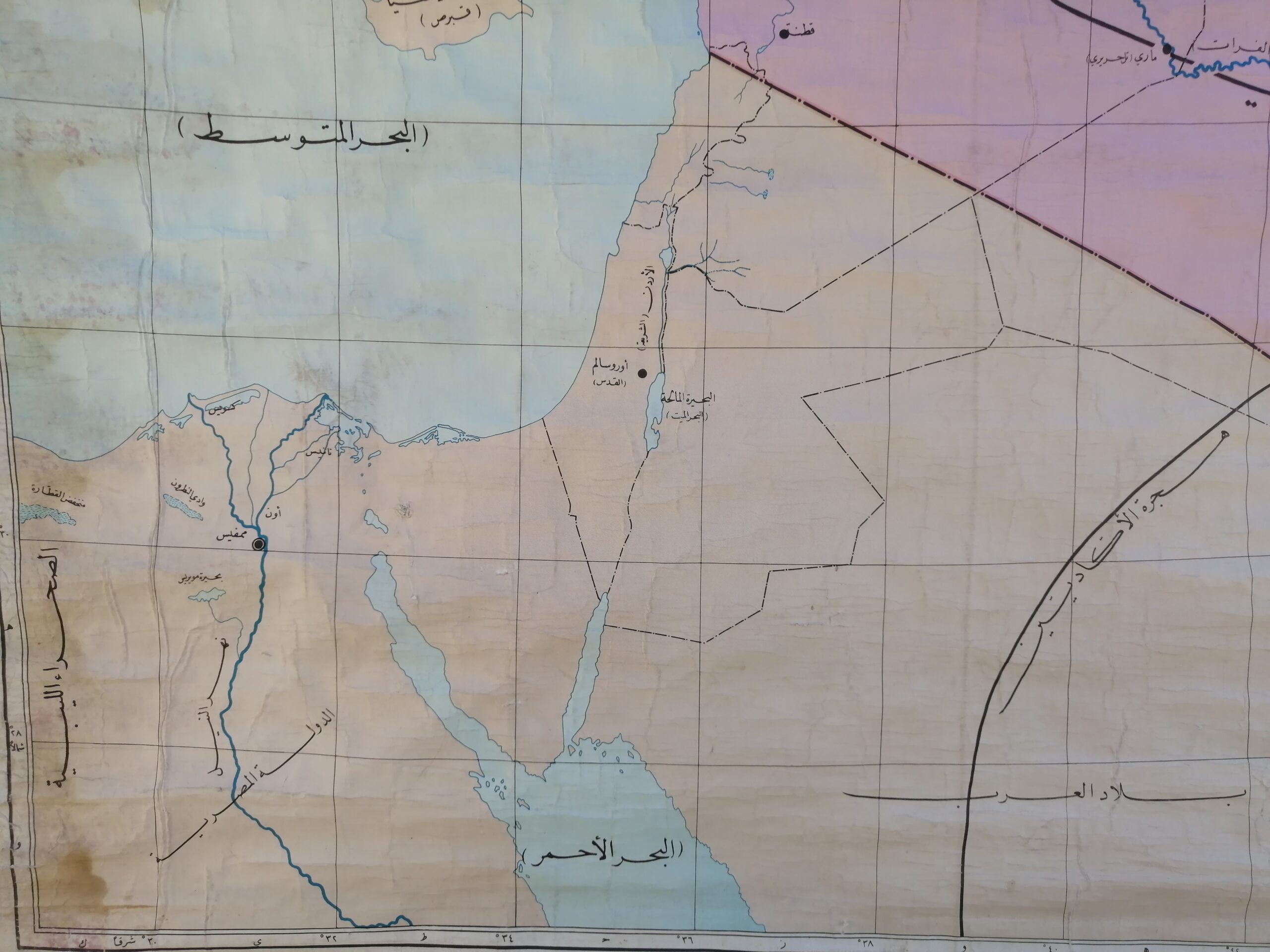
A rare and captivating antique wall map printed in Arabic, illustrating the extent and movements of the Akkadian Empire (circa 2350–2150 BCE), one of the earliest known empires in Mesopotamian history. This historical map showcases the heartlands of ancient civilizations, including present-day Iraq, Syria, and surrounding regions, with markings for rivers like the Tigris and Euphrates, major cities, and migration routes.
Language: Arabic
Map focus: الإمبراطورية الأكادية (The Akkadian Empire)
Period depicted: Ancient Mesopotamia (3rd millennium BCE)
Estimated print date: Early to mid-20th century (likely for educational or governmental use)
Material: Paper mounted on linen with wooden rollers
Condition: Aged patina with visible water stains and wear, adding authentic character
A perfect collectible for historians, educators, or lovers of ancient Middle Eastern heritage. Ideal as a wall display in libraries, offices, or themed décor settings.


Reviews
There are no reviews yet.