
Description
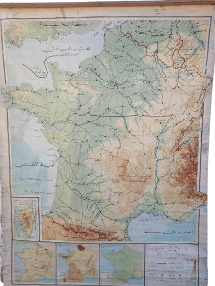
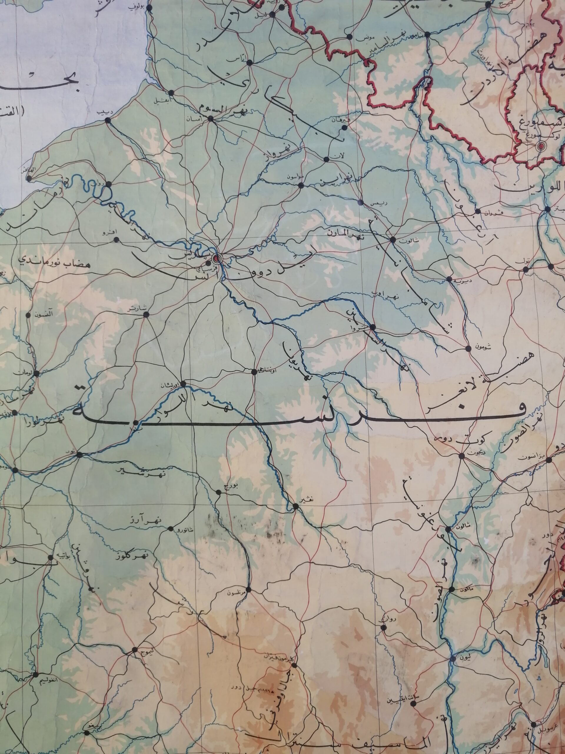
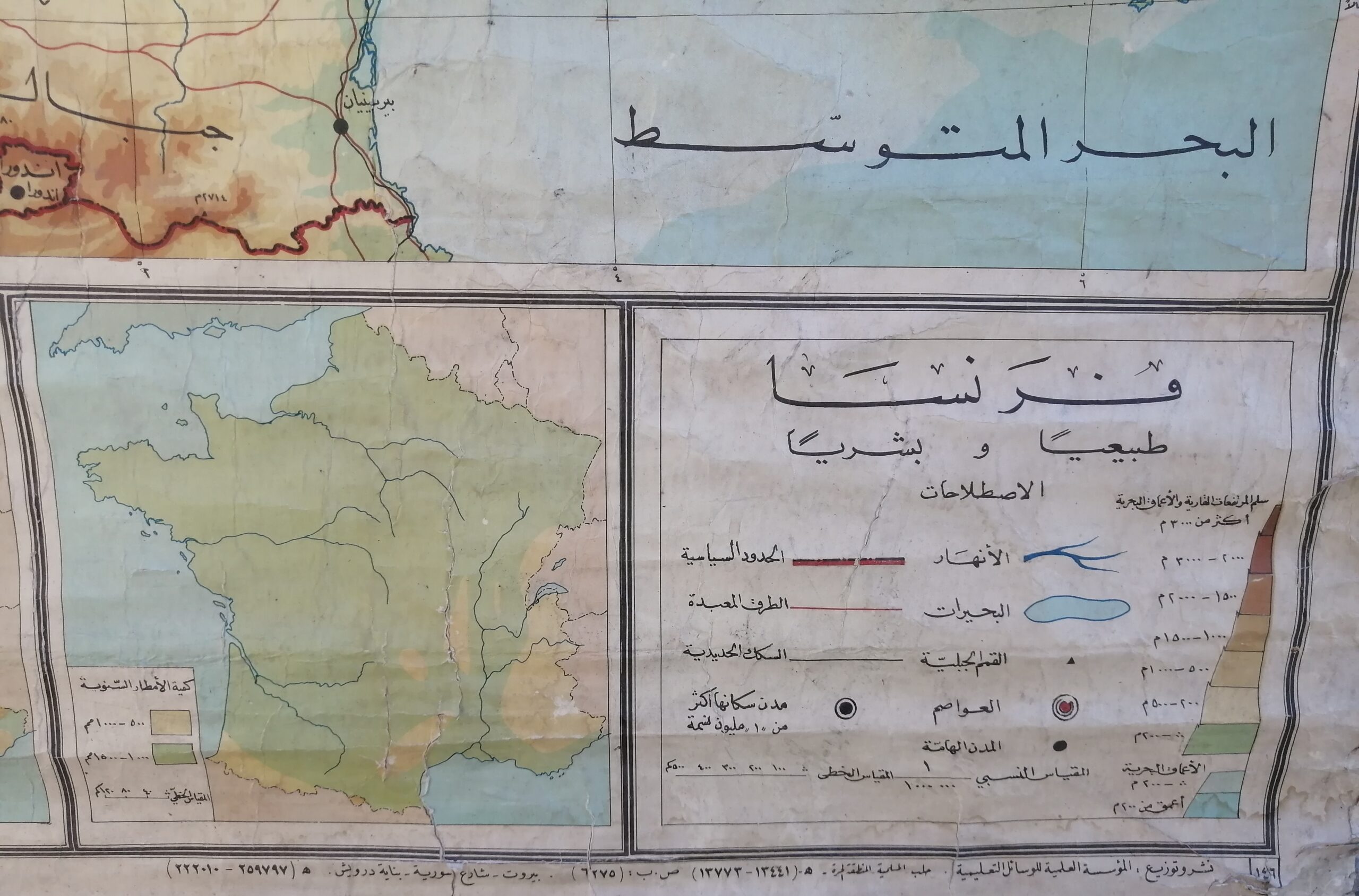
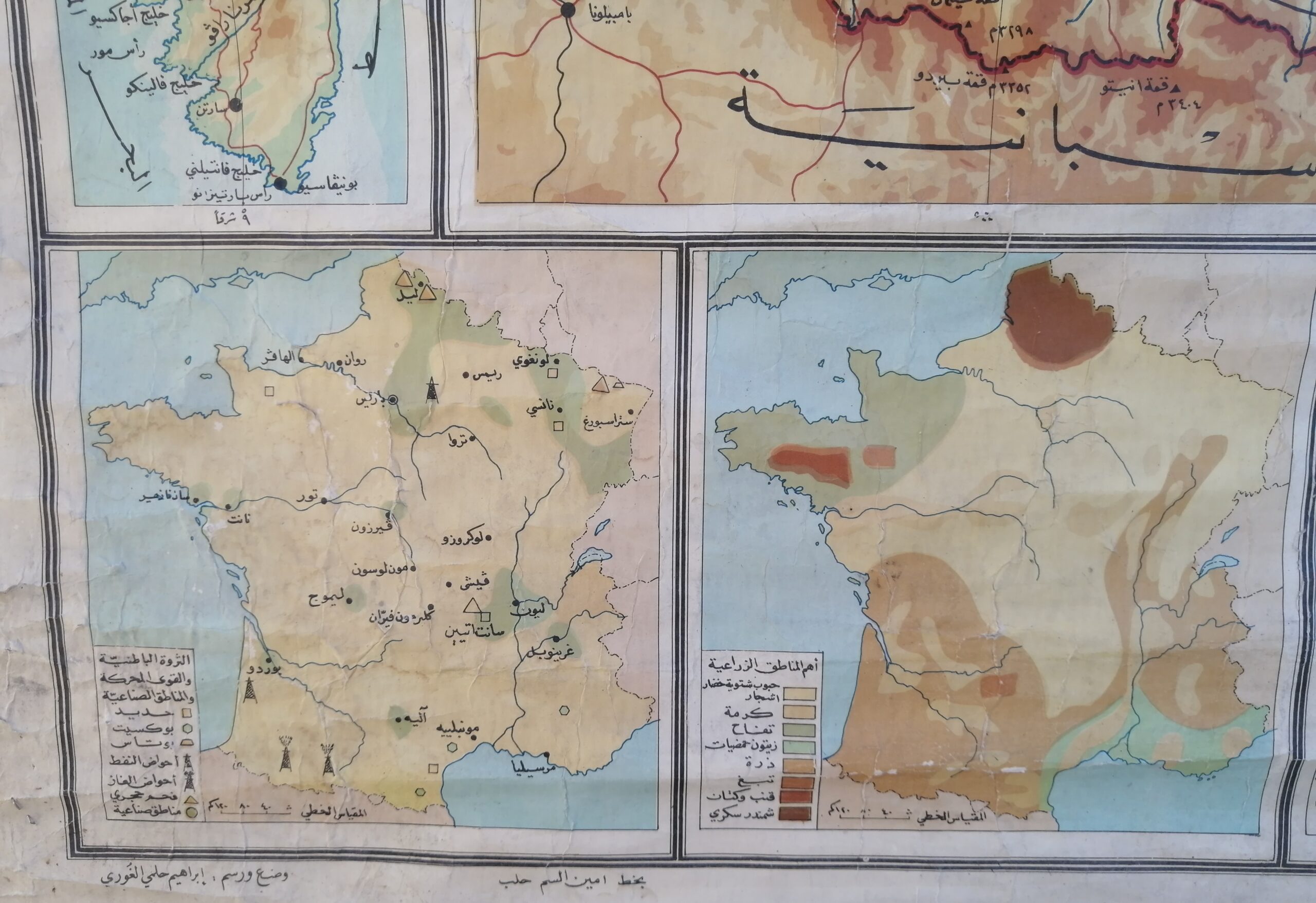
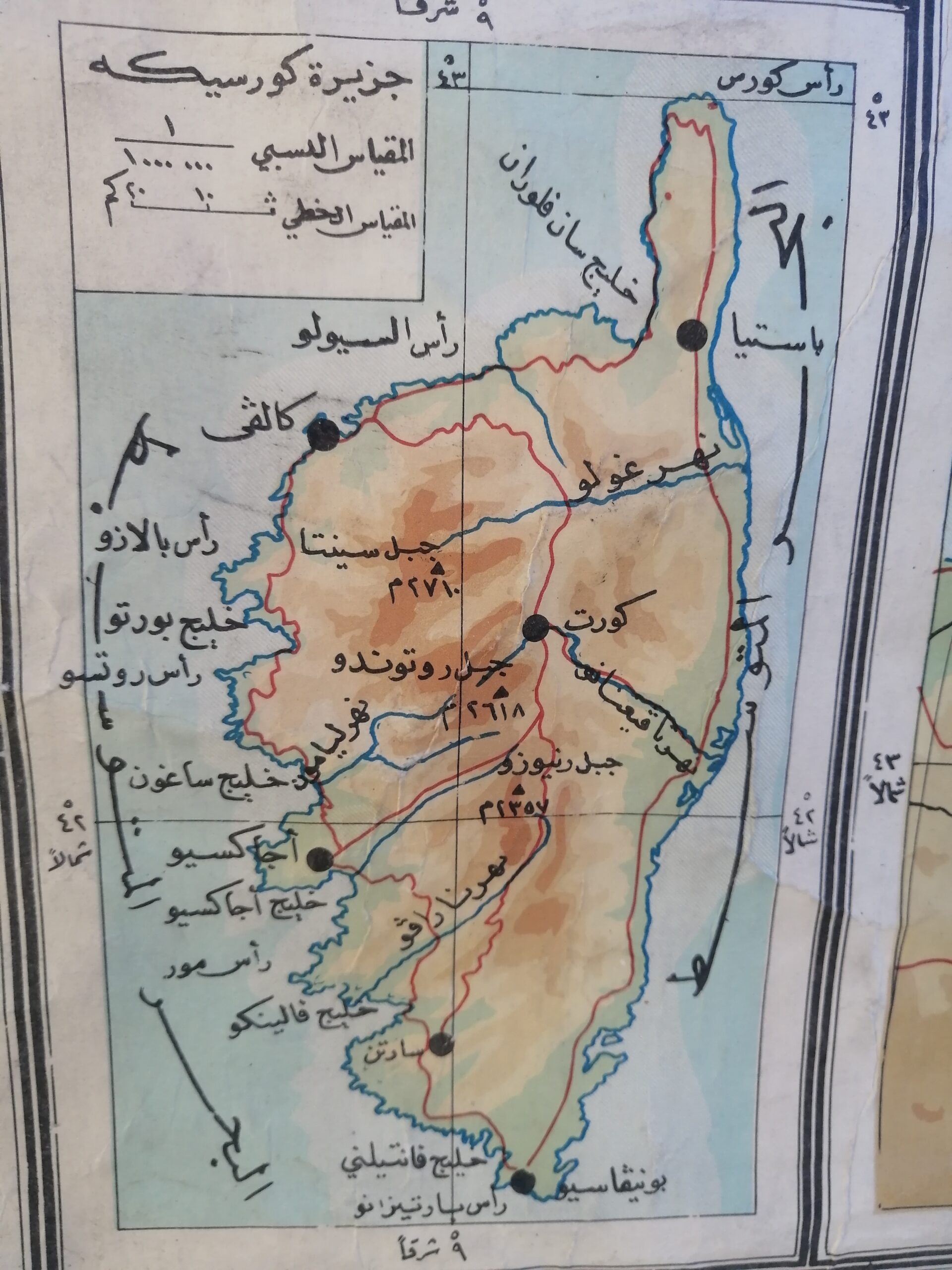
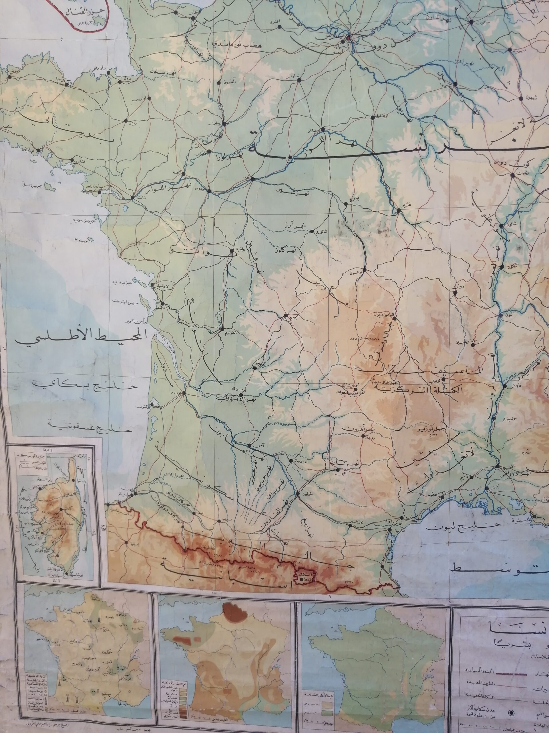
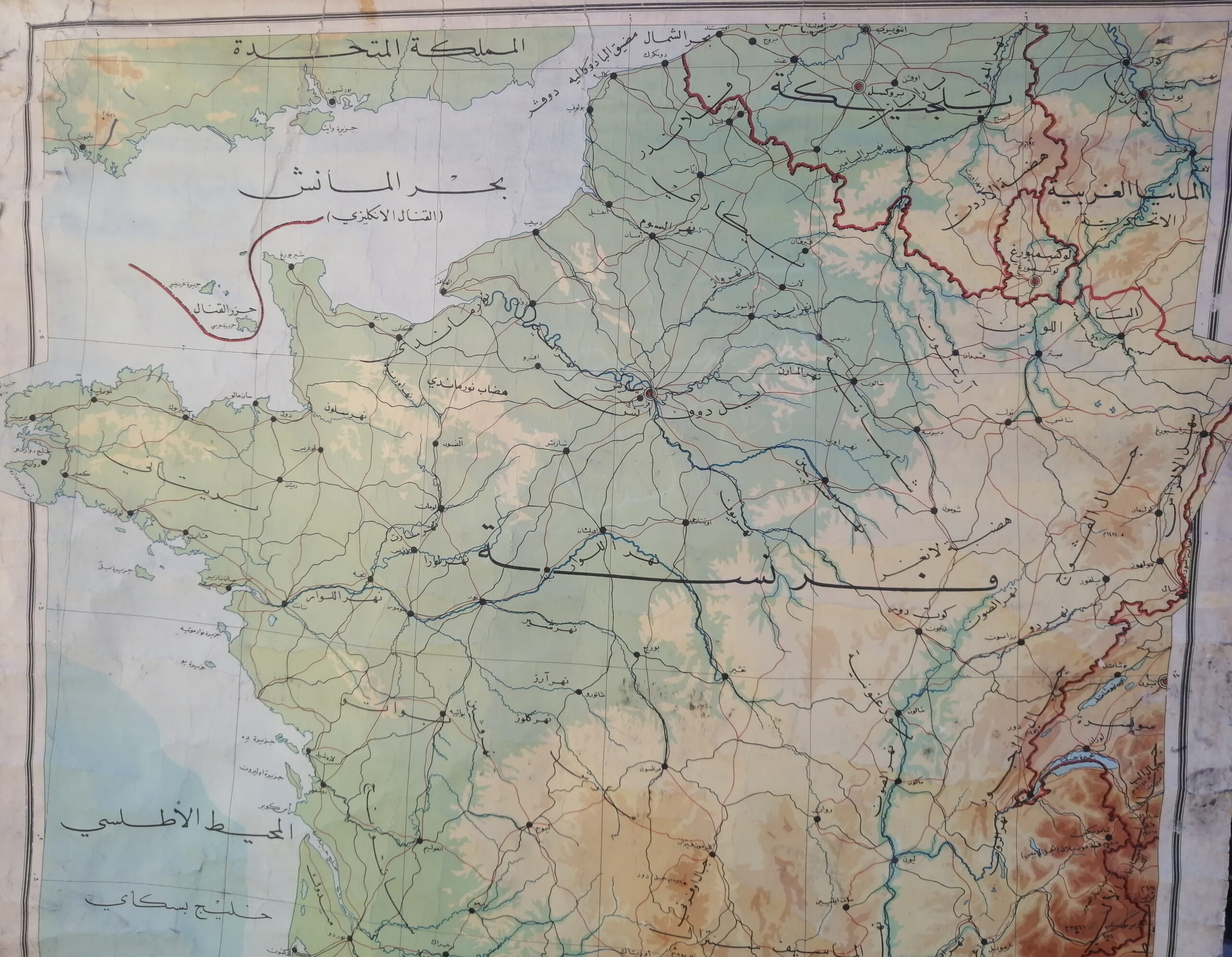
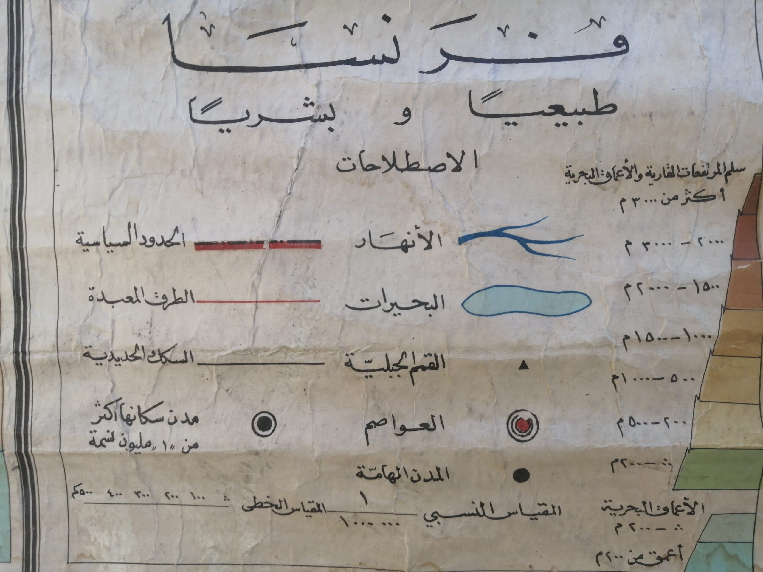
A rare and visually striking vintage physical map of France, labeled entirely in Arabic, likely dating from the mid-20th century. This large-format educational wall chart showcases detailed topography, river systems, and transportation routes of France, with insets including the island of Corsica and several thematic maps (climate, geology, population, etc.).
Originally used in Arabic-speaking schools or institutions, this piece reflects the intersection of French geography and Middle Eastern academic influence. The map is mounted on canvas with wooden rods and shows charming signs of age: minor edge wear, soft fading, and a beautifully weathered patina.
A unique collector’s item perfect for antique map lovers, Francophiles, or anyone seeking a statement wall piece with both historical and cultural depth.
Condition: Good vintage condition
Origin: Lebanon


Reviews
There are no reviews yet.